Hiking through the remote Chequamegon National Forest in northern Wisconsin has long been on my radar. I once interviewed several hikers who completed the whole trail, and they pointed to this section in Taylor County as their favorite. This speaks volumes since the trail will be 1,100 long when completed. After several years of the idea bouncing around in my mind, I finally got out on an Ice Age Trail backpacking trip and enjoyed a great adventure.
Related: Isle Royale National Park misadventure
Camping at Spearhead Point
For the first two days of the trip, I camped in the Chequamegon National Forest Campgrounds along the Mondeaux Flowage. I really enjoyed these campgrounds. They are just as spacious as the state park campgrounds, they are cheaper, and not as crowded. My trip was on Labor Day weekend, one of the busiest outdoor weekends of the year as everyone wants to get one more camping fix before school starts. I figured that the national forest campgrounds and hiking a remote trail would be the best option on this busy weekend. I discovered this campground thanks to Best Wisconsin Tent Camping book by Kevin Revolinski.
Day hiking from Spearhead Point
The first full day, I hiked from the Spearhead Point Campground west on the Ice Age Trail. The trail followed the Mondeaux Esker for the beginning of this segment. An esker is a ridge created by the melting waters of the glacier. It is basically the remnants of a glacial river. Hiking on an esker is ideal because they are usually flat. The Mondeaux Esker enjoys views of the Mondeaux Flowage on one side and the thick Wisconsin northwoods on the other. I hiked for two hours and turned around.
Ice Age Trail backpacking from 64 to Jerry Lake
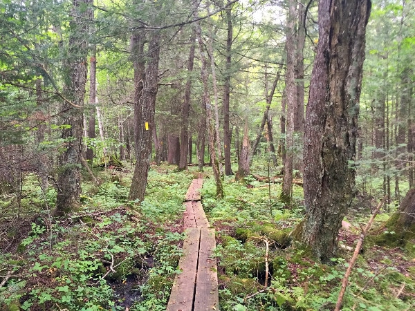
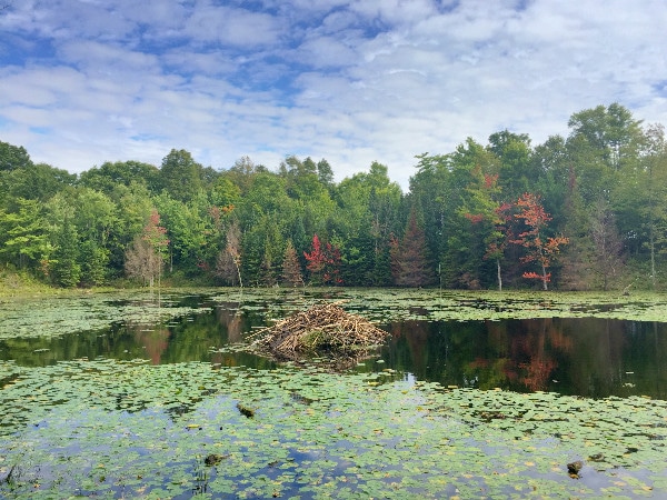
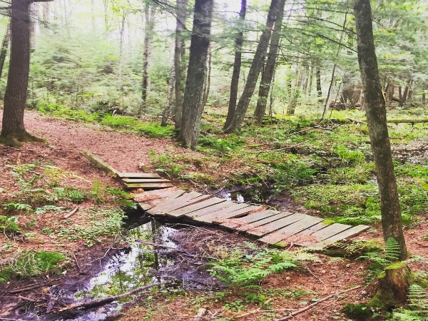
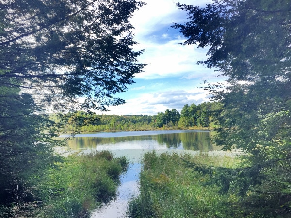
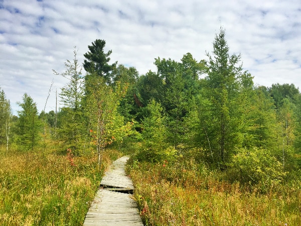
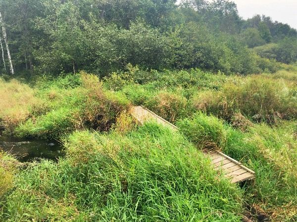
I parked my car at the parking lot on Highway 64 and walked east towards Jerry Lake. The first 3.8 miles goes through a very wet but scenic section highlighted by bogs and ponds. Immediately after exiting the parking lot, a picturesque pond appears on the right and a beaver dam on the left. You then walk through a cattail wetland over a boardwalk. This would be a tough section to hike in the spring when the land is still wet from winter snow melt and the mosquitoes are ferociously emerging, but in early September it was dry enough to hike. The mosquitoes were still present, so repellent is a must.
Related: Completing the Outer Mountain Loop
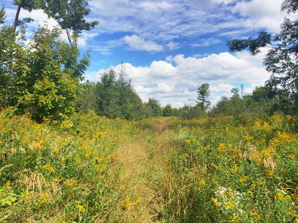
The trail then enters a wetland prairie. This is the only section where the trail is out in the open. Apparently the openness is due to a 2002 tornado. Most of the rest of the trail is in the woods except for the occasional road crossing. It was nice to see the surrounding countryside and the wildflowers were in full bloom.
The first road crossing
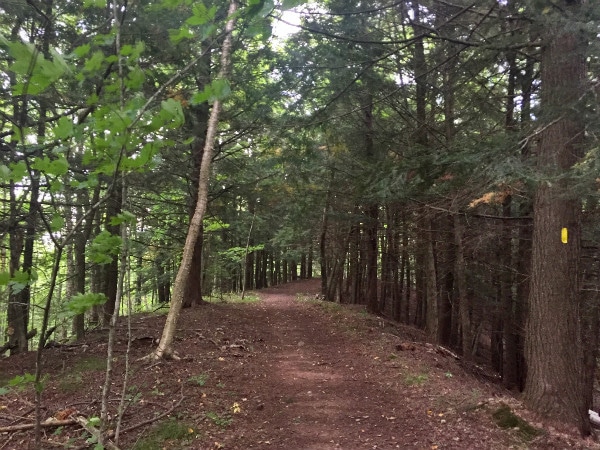
After the first road crossing, most of the rest of the trail during this segment is in the thick woods. There are sections that are a little wet and muddy, but they are only in the low ground areas. Sooner or later, the trail will gain some elevation and leave the muddy areas behind.
State of the trail
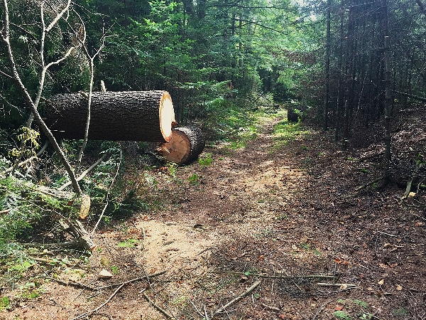
The trail maintenance for this section of the trail was first rate. Any time the trail merged or diverged there was an arrow. There were numerous yellow blazes or diamonds letting you know you were on the right trail. The trail itself was well defined as I am sure this is a popular stretch, so it was well worn down. There were many new bridges and also fresh cuts of timber where trail maintainers had recently cleared the trail with a chainsaw. I was definitely impressed with the condition of the trail. The Ice Age Trail is maintained by volunteers. I would like to thank them for their diligent work making this trail experience incredibly awesome.
Between the first road crossing and Jerry Lake I would categorize the trail as rugged. There are many up and down sections during this roughly ten mile march. The trail is not overly difficult though as the elevation climbs are reasonable in nature. They are enough to get your heart pumping, but not enough to break you; however, they will wear you down if not in good shape.
Lake Eleven
If you are parking at 64, this is probably where you want to camp the first night. I wish I would have stayed here myself. It is about 10 miles from 64 to this campground. There is a nice little fire pit a few feet from the lake.
Related: Achenbach Trail hiking in Theodore Roosevelt National Park
Jerry Lake
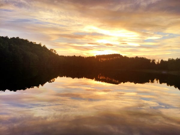
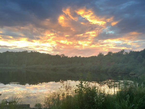
I opted to camp at Jerry Lake. This is about a 15 mile hike from 64. I am a little out of backpacking shape, so it was not an easy hike. I endured and showed up near sunset to Jerry Lake. There were two other campers at the spot. This was not a problem as there was plenty of level ground for me to put up my hammock. I set up my GoPro for the sunset over Jerry Lake and set up camp.
Oddly enough, there is a cell tower on Jerry Lake that serves the small community of Perkinstown, so it was a rare privilege to actually have coverage in the wilds of Wisconsin. There is also a road and a parking lot only a half mile on Sailor Creek Road. I cheated and stashed my cooler and camp chair in the woods by the parking lot, so not only did I have coverage, but I also had cold beer and a comfortable chair. After Ice Age Trail backpacking for 15 miles, I felt I deserved this treat.
What comes out must come back
I had the pleasure of hiking 15 miles back the next day. Like I said, I definitely would recommend a shorter hike. I was so glad to see my car after I emerged from the woods, but it was not because I did not enjoy my Ice Age Trail adventure.
Things to know about this stretch of the Ice Age Trail
- No permits are required and there is no charge for camping
- Camp must be 200 feet from the trail and from water
- There are several roads that cross the trail, so you can park your car on these roads to make a shorter trip if you want to hike to Jerry Lake and do not want to opt for a 15 mile hike
- There are bears in these woods so be sure to hang food and keep a clean campsite
- Be sure to consult hunting dates and wear bright orange during deer hunting season
- Even though Jerry Lake has cell coverage, not all of the trail here does, so do not count on it and be sure to bring compass
- There is plenty of water on this stretch with several lakes and stream crossing, but be sure to treat
- Consult the Ice Age Trail Alliance website for more information
Related: Hiking Timm’s Hill the highest point in Wisconsin without a sherpa
Adventure on!
The goal of Traveling Ted is to inspire people to outdoor adventure travel and then provide tips on where and how to go. If you liked this post then sign up for the email newsletter. Notifications are sent out once or twice a month with what is new with Traveling Ted’s adventures. There is no spam and email information will not be shared. Other e-follow options include Facebook (click on the like box to the right) or twitter (click on the pretty bird on the rainbow above).







This makes me so homesick for the U.S. I have been on the road worldwide with my wife Laurel for a few years and we are kind of missing home now. The great north of the U.S. is beautiful but so much different that what we have been trekking in Mongolia, Nepal, and Myanmar since March of this year. The trails are much flatter and well maintained. We are lucky to even have a marked trail. Great photos and I loved your focus.
John Rodgers recently posted..Naadam: The Olympics of Mongolia
Thanks John,
Yes, the U.S. northwoods are special. I do love visiting other countries as well, but don’t think I could ever leave the northwoods for too long of a spell. They have a way of calling me back.
Looks like a great trip. I’m actually trying to plan a weekend hike in the same area within the next couple weeks. It seems like there are two segments for the Jerry Lake section. One being from Jerry Lake (probably where you dropped off your cooler and chair) going north east to Modeaux Flowage. The other being your hike (64-Jerry Lake).
I believe your day hike from spearhead would of covered some of the first hike mentioned. So my question is, why did you choose to do the 64-Jerry Lake route? Was it more enjoyable than the small distance covered from your day hike?
Just trying to justify which hike to do. Also Where along 64 is the trailhead?
Hello Caleb,
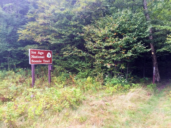
There was no real rhyme or reason why I did the hike from 64, and why I did the day hike from Mondeaux. I was staying at Mondeuax Flowage, so I just started walking from there. The next day I wanted to do a night camping along the trail. I looked on the map and 64 to Jerry Lake seemed like a good route and distance. The trail is equally nice from either direction. 64 to Jerry Lake is 15 miles, so it is not an easy day. 64 to Lake Eleven is 10 miles. The trailhead on 64 is only a couple miles east of 73. There is a big brown “Ice Age Trail” sign. You cannot miss it. Enjoy.
Do you know if there is a shuttling option in the area?
Hello Jeremy,
Thank you for reading and commenting, and I apologize for the delay getting back to you. As far as I know, there is no company that provides such a service up there; however, here are a few ideas for you.
1. Try going into the local bar and ask the bartender if he knows anyone agreeable to shuttle for a fee.
2. Uber/Lyft might be an option. I think Lyft is now in the area, but not completely sure about this.
3. Contact the Ice Age Trail Alliance Chapter for the region. Depending on how active the chapter is there, they might be happy to arrange a ride.
Thanks for sharing your experience with us. I’ve been very curious about this segment and your post made me a little more confident that I can tackle it. Cheers!
Hello Christopher, it is a beautiful stretch of trail. Enjoy!