After failing to do the Achenbach Trail, I spent the evening checking out the Scenic Drive in the Northern Unit of Theodore Roosevelt and enjoyed a beautiful sunset along the Little Missouri River. My next plan was to hike the Buckhorn Trail. I was thinking of doing both the Buckhorn and the Achenbach, which would have been 18 miles and two river crossings, but when I visited the ranger station, they were not sure when the river would go down. I opted to play it safe and do the Buckhorn Trail, which has no river crossings.
Related: Hiking the Achenbach Trail
Beginning the Buckhorn Trail
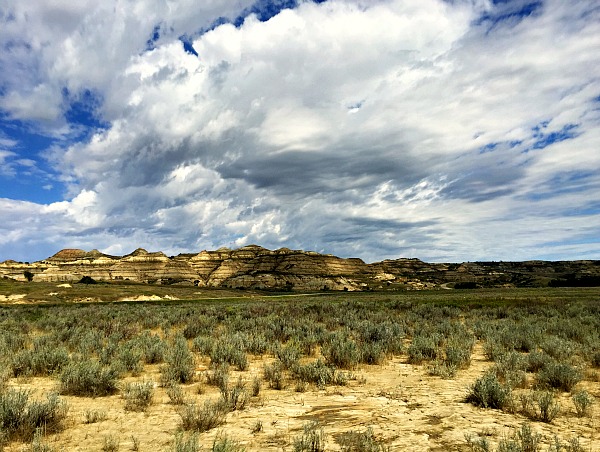
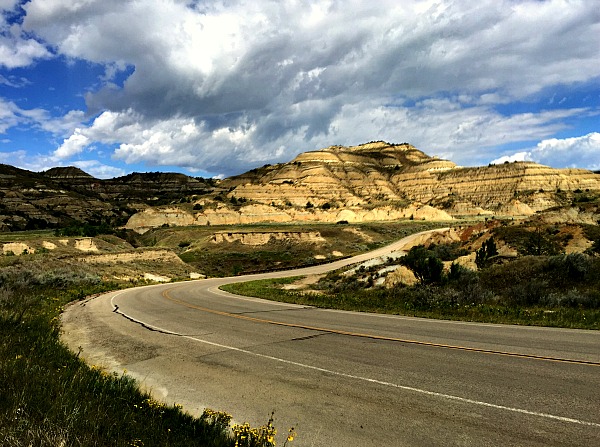
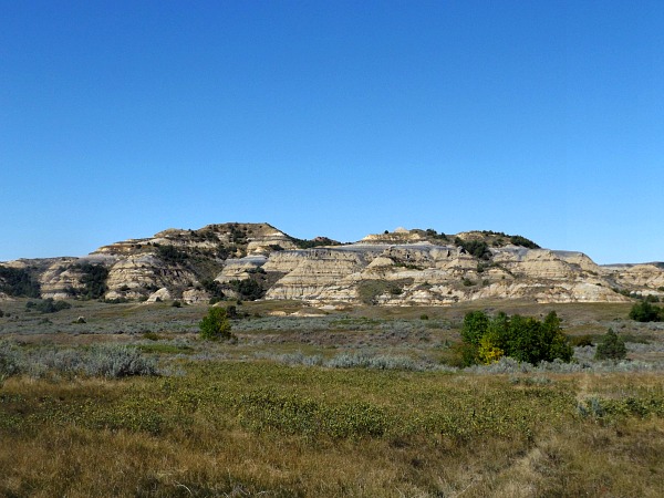
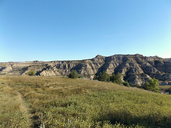
It turned out to be a good choice. Actually, I don’t think any choice you make in Theodore Roosevelt National Park is a bad choice. It is like the Grand Canyon in the respect that just about wherever you are, you are bound to have a beautiful view. Even the sections on the prairie are nice and if you don’t enjoy the prairie then just keep moving and soon an amazing badland formation will come into view.
I started once again in the Juniper Campground picnic area, but instead of crossing the Little Missouri, I followed it for a spell on the Little Moe Trail before following veering closer to the road and eventually crossing it into the more remote backcountry.
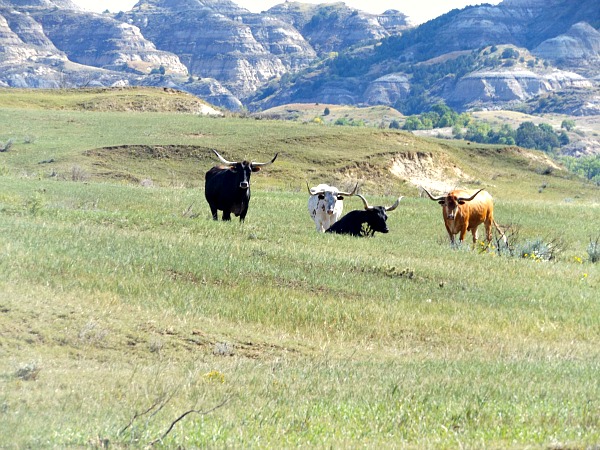
I came around a bend and faced a group of Texas longhorn steers that did not seem to glad to see me. The trail skirted only 100 yards from them, so I decided to take a long arc around them. This seemed to appease them, and they just watched me with mild curiousity.
The first part of the trail went through the open prairie following the Scenic Drive. The bright side of this was the scenery was amazing. The bad part was you were in full view of every car that drove by. I could see each car stare at me just like I was a bison. People in their cars were even more curious about me when I took the GoPro out and started taking time lapse videos. They were wondering why someone was in the middle of the prairie.
Entering the rugged Theodore Roosevelt backcountry
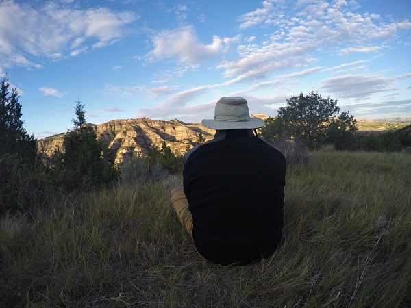
Eventually the trail crossed the road and left it behind for the more remote and rugged Theodore Roosevelt backcountry. I only went a mile when I found the absolute perfect camp. There was a grassy knoll on top of butte with just the most amazing view ever. It was only two p.m., and I had only gone four miles, but the total trail was only twelve. I knew I could easily hike eight miles the next day by noon, and I was in no hurry the next day anyway. This is the nice aspect of doing a more moderate trail.
The decision to stay here was a good one. I just gawked at the bluff all afternoon after setting up camp. If the view was not already ridiculously amazing during the day, it even got better at night. The northern lights danced over the bluff for about an hour once it got dark. At first I though it was reflection from cars on the highway as there was a road on the other side. I ruled this out when green lights continued to shimmer even when no car sounds could be heard.
The next morning I bid my fabulous campsite goodbye and continued the hike. Theodore Roosevelt can be a rugged place. The elevation is not that extreme, but when you go up and go down, you do it quickly as the bluffs are at a steep incline. The rain that prevented me from hiking the Achenbach Trail turned parts of the trail into a muddy swamp. I slipped and slided through the lower sections in the valleys. The hiking is not as hard as mountain hiking, but it should not be taken lightly either.
Fortunately the terrain higher up was dry. Apparently the bentonite clay, which is the blue clay in the buttes, gets incredibly slick when it is wet and can make a five minute climb up the bluff into an hour according to the ranger. Fortunately, the clay had dried by the time I hiked here.
Another difficulty was keeping up with the trail. There were trail signs every half mile, so it was well marked for the most part, but there were times it was not easy to follow in between those markers. One time I found myself on the other end of a steep wash, and I had to back track a few hundred feet and jump over the ravine at a narrow spot to get back on the right side. Another time, there was no marker at a side trail that went to a spring, so I visited a spring and found myself far off the trail. I was able to see the marker in the distance and walked cross country across the prairie.
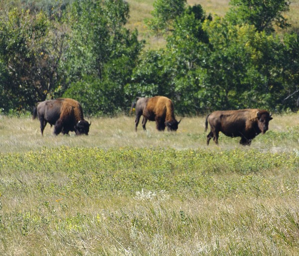
When I did this, I came across a herd of buffalo that were in a nook in the field as I came over a hill. They were right in the way of where I wanted to go, so I had to make yet another arc around them. They actually started moving as I arrived. They seemed much wilder animals than the bison that grazed along the Scenic Drive.
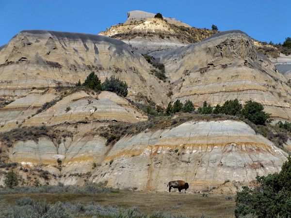
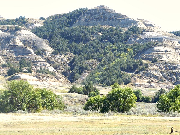
The last part of the trail goes right through a couple of prairie dog towns in a valley with superb views on both sides. One bluff had a huge bison sleeping right at the base of one butte. He woke up and got up as I passed, but he just stood there. He was pretty far away, and I knew he would not want to come any closer.
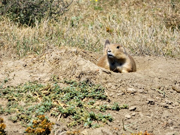
I cannot say this guy was my biggest fan – He chattered at me non-stop until I left the prairie dog town – Thanks for the hospitality buddy
Soon enough I was back at Juniper Campground and back to my car. I was disappointed I was unable to hike the whole Achenbach Trail, but the Buckhorn Trail was an able substitute. It had some amazing views and gave me a taste of the Theodore Roosevelt backcountry. I saw only two other hikers on the trail and only three day hikers. Once I camped, I saw no one the rest of the night.
Buckhorn Trail hiking tips
- You need to carry all of your water as there is no approved drinking water in Theodore Roosevelt National Park
- The Buckhorn can easily be completed in a one day hike or easily done as an overnight backpacking trip. It takes about six hours to complete
- Keep your distance from both bison and Texas longhorn steers
- There are prairie rattlesnakes, but I did not see one – Keep an eye on the trail and rocks and look for movement – Do not be overly paranoid as snakes will do everything they can to avoid you
- Best time to hike is in September, October, and November or early April and May if the spring is not too wet
- There is shade, but long stretches of the trail are without shade so bring suntan lotion and a hat
- Buckhorn Trail is 12 mile loop – You can start in the campground or where it crosses the road
Adventure on!
The goal of Traveling Ted is to inspire people to outdoor adventure travel and then provide tips on where and how to go. If you liked this post then sign up for the email newsletter. Notifications are sent out once or twice a month with what is new with Traveling Ted’s adventures. There is no spam and email information will not be shared. Other e-follow options include Facebook (click on the like box to the right) or twitter (click on the pretty bird on the rainbow above).





Greetings Ted, thanks for posting this. I found this scouring the web for tips on back country camping spots in TR NP. Yours is the only found so far. If you see this and have and are inclined so share the GPS coordinates I would be very grateful. Thanks again for the post.
Here is my favorite in Badlands National Park, SD. Deer Haven on the Sage Creek Loop trail
43.8417, -102.2346
https://i1298.photobucket.com/albums/ag44/daniel_utz1/Badlands/41911472_10156036628527462_5227510652804792320_o_zps26qdiike.jpg
Hello Daniel,
Thank you for reading and commenting. It looks like a nice campsite you have there. I am sorry, but I do not know the GPS coordinates. I just found it on the map. I was going to hike the Auchenbach Trail, but high water on the Little Missouri made that impossible. Thanks again.