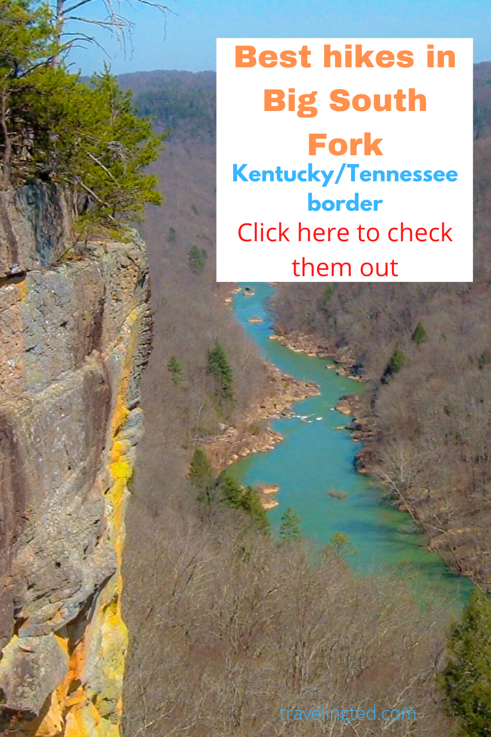
The Big South Fork National River and Recreation Area along the Kentucky and Tennessee border in the Cumberland plateau is a large swath of federally protected wilderness centered around the Big South Fork River, which is a fork of the Cumberland River. The focus of this post is on the best hikes in Big South Fork.
Related: Best day hiking ever in the Great Smoky Mountains
Best hikes in Big South Fork
There are wonderful overnight hiking opportunities in the park with the 269 Sheltowee Trace Trail, the John Muir Trail, and over 150 miles of trails overall in the park. There is an abundance of trails in the park ending with waterfalls, creek loops, natural bridges, and overlooks.
These are not the five best, but five trails I have hiked and recommend. Other popular trails I have not hiked include Slave Falls, Dome Rock House Loop, and Honey Creek. Some of the trails in the park are hiking only and some are shared mountain biking trails.
Five Best hikes in Big South Fork
Angel Falls Trail – 2 miles one way from the Leatherwood Ford Trailhead near Bandy Creek
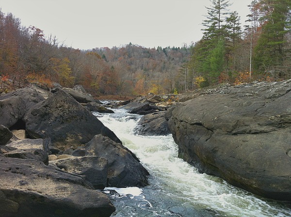
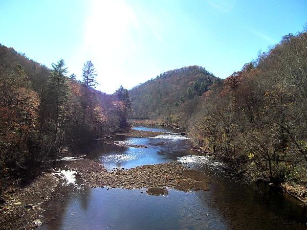
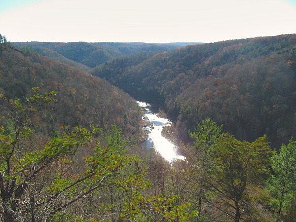
Angel Falls is actually not a falls, but a powerful torrent. Those who explore this trail expecting a breathtaking waterfall might be disappointed. They should not; however, as it is a picturesque path along the river with chances to explore the shoreline with sensational views of boulders along the river and bluffs towering over the river.
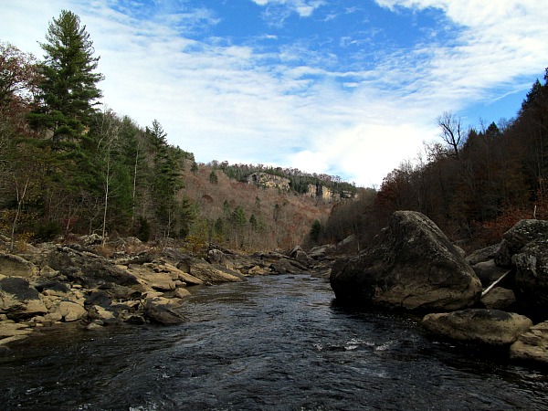
Best hikes in Big South Fork – Big South Fork at its best – Beautiful river with gorgeous rock faced bluffs
The trail is undemanding with scant elevation change thanks to hugging the river and is wide with decent footing. Once you hit the rapids you can explore hopping along the boulders to get better views of the rapids. Be careful hopping on the boulders as they can be slick and also look out for snakes. This is copperhead country although I have never seen one here.
Angel Falls overlook – 2.8 miles one way from the Leatherwood Ford Trailhead near Bandy Creek
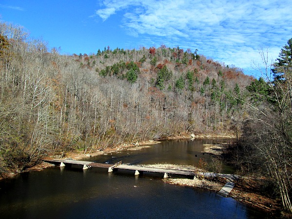
From the Leatherwood Ford parking lot cross a low water bridge to ford the river and get to the trail on the opposite side. At the time, this bridge was under repair, so I imagine it should be completed by now. Once the bridge is crossed, a stairwell to the right immediately descends back to the trail.
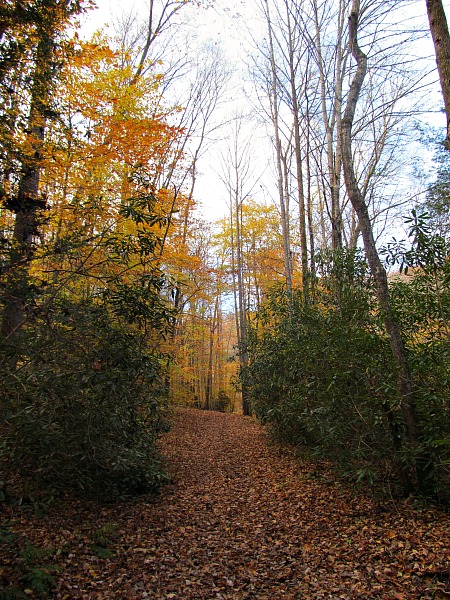
I thought this trail would be exactly like the trail on the other side of the river, but with different views of the bluffs, but it was a little different. It goes up a little higher and farther away from the river therefore giving nice perspectives of the river and it is more of a woodland trail than a river trail.
Once you cross Falls Branch Creek the trail goes straight up to the Angel Falls overlook. The last .8 miles are just about straight up.
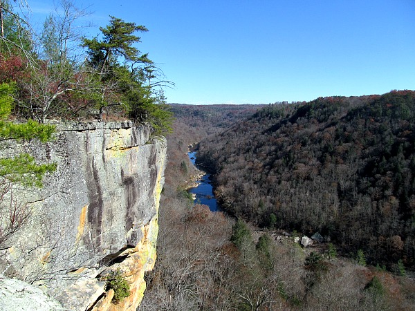
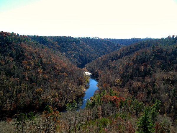
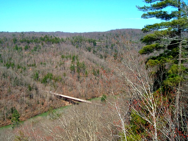
You then flank around the rock outcropping and come up to one of the most beautiful overlooks in the eastern United States. You can also get to this overlook from Bandy Creek.
Twin Arches – .7 miles one way for short option – 6 mile loop for longer option – Twin Arches Road off Divide Road
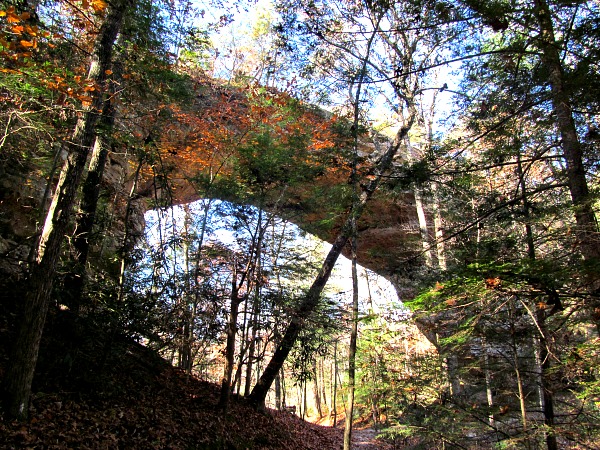
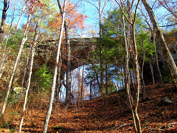
Twin Arches are two natural bridges adjacent to each other. A phenomenal picture capture is available if one could get both bridges in one picture, but it is difficult enough to take a picture of one arch. The arches occupy the middle of the woods, so if you get immediately in front it is hard to get a whole arch in and if you get too remote there are too many trees in the way.
Related: Big Bend Outer Mountain Loop hiking trail
This is a nice hike through the woods and fairly easy if you do the shorter route. There are a couple of stairways that make the hike a little more effortless. I did not do the prolonged option, so I cannot describe what the loop trail is like.
Yahoo Falls – Out and back to the falls is just under a mile – There is also an 8.5 mile loop
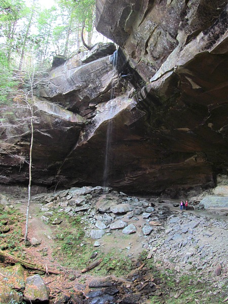
This is a nice trail through the woods in the Daniel Boone National Forest, but the main attraction is Yahoo Falls, which is the tallest falls in Kentucky. Unfortunately, it was Yahoo trickle when I visited. Save this hike for the spring or after heavy rains the rest of the year.
I was tricked by Instagram into visiting this waterfall. I saw a spring picture of the falls and it was a deluge of flowing water.
Leatherwood Loop and Overlook Trail – 5 miles total – Near Bandy Creek
My favorite aspect of a trail is options. I prefer a loop to an out and back. It is possible to skip the hiking all together if you just want to see the fantastic East Rim overlook. The road ends at the overlook parking lot.
Due to several different trailheads you can do the whole section out and back, which would be a 10 mile round trip hike or you can do a shorter route. The hike from the last trailhead on the East Rim Drive to the Sunset Overlook is three total miles.
The Big South Fork is an underrated destination. With each visit, I am amazed at the paucity of visitors especially hiking the trails. Overshadowed by its eastern neighbor, the Great Smoky Mountains, but with 150 miles of trails and many great day hikes, it is a spot that will keep me coming back again and again. Check out their website for more information and to look at trail maps.
Places to stay in the Big South Fork
Two campgrounds are found in the recreation area. Bandy Creek lies in Tennessee and Blue Heron in Kentucky as the park encompasses a huge belt of territory in both states. If you want a more luxurious option, try a cabin or tree tent at Charit Creek Lodge.
Adventure on!


Very nice Ted. I’m crazy afraid of snakes so maybe I’ll attempt this in the colder months. The trails look like the type my son and I could do pretty easily. Not sure if my wife would be game, though.
Trips By Lance recently posted..Red Cat House: A Haven in the Heart of Taos
Thing about snakes is they are deathly afraid of humans. If you practice a little caution you probably will never even see one. I went walking around Lumpini Park in the middle of Bangkok and later read they have deadly pit vipers there. Not unusual seeing this part of the world has tons of dangerous snakes, but crazy they live even in downtown Thailand.
I love rivers, so Angel Falls looks perfect for me. I wish I had time to do some hiking when I was in Tennessee a few weeks ago. Thanks for sharing!
Christy recently posted..See What You’re Missing in Southeast Alaska
This would be a great river to canoe, raft, or fish on. The views of the bluffs from the river are superb.
I’m a city girl first, but mountain woman a close second. LOVE the views!!!! You’re making me want to go and hike that area. Really.
Pola (@jettingaround) recently posted..Featured Photos: Avenida Corrientes in Buenos Aires
Great place to hike and not too crazy far from Chicago.
I really need to check this place out. You know I’m a big proponent of national parks/recreation areas/etc., yet Big South Fork has eluded me. It looks so beautiful in your photos!
Francesca (@WorkMomTravels) recently posted..#JAchat topic: Street photography. Focus: Istanbul.
For most, Big South Fork is a sign along the interstate. I have passed it many times until I finally went three years ago. Now it is a favorite.
What beautiful fall hikes! no snakes for me either puhlease!
lola dimarco recently posted..It’s #Movember – That Means Mustaches & #ManlyMoments
I think it was a little late for snakes with the cold nights.
Each an every photo is beautiful. I love nature and i prefer to explore and bitten by a spider or snake rather than not to. Thanks Ted for a great article.
Jeff recently posted..America On Wheels: Planning Your Road Trip
No desire to be bitten by a snake either Jeff.
No snakes for me please… love the photos!
@mrsoaroundworld recently posted..The Luxury Travel Blog Network – November 2013 Edition
No snakes seen on this trip. I am in SE Asia now though, so I hope to see a couple here.
well, veto on the snakes, but we could maybe risk our lives for some leaf peeping. maybe. liquid courage might help matters, too.
the lazy travelers recently posted..laws to travel by – #48
I once saw a copperhead coiled up in a bunch of dead leaves. I would have walked past him and been two feet from him had I not seen him. I doubt he would have done anything though unless I stepped on him. A little liquid courage always helps.
Aww this makes me miss hiking. I haven’t been in forever, and you’re getting me inspired! I’ll have to do these day hikes eventually.
Erin at The World Wanderer recently posted..Street Art of London: Photo Essay.
Hope you get outdoors and start adventuring again soon.
your photos are crisp and fresh looking.. so much so that I could almost feel the clean, fresh air on my skin. These are my kind of hikes.
Thanks Mary Anne. Easy to photograph such a beautiful place.
Looks not only like a beautiful place but a beautiful time go see it!
Raul (@ilivetotravel) recently posted..Great Drive Series – A Switzerland Sampler
I missed the best time by about a week or two, but the good thing about this is less people after the leaves fall. I had the park to myself except for deer hunters.
There is not one of those hikes that doesn’t look amazing – even if they are short. Can you snowshoe on any of them in the winter?
Leigh recently posted..A Hike to Nigel Pass in Jasper National Park
You probably could, but they don’t get a lot of snow. This area is south of the snow line, but since there is elevation involved, they do get some.
Ted, there are no water moccasins in the Big South Fork. Only dangerous snakes are Copperheads and Timber Rattlesnakes.
Hello Jack,
Thank you for letting me know. I guess I just assumed that there were since there are water moccasins in southern Illinois, but looking at their range, I see you are correct. I also thought they were found in the Smokies, but I see they do not inhabit that park either.