Hiking the Appalachian Trail is a gigantic undertaking. The amount of training, planning, and preparation needed to conquer America’s most iconic long distance trail intimidates even the most seasoned backpacker. The National Geographic Appalachian Trail map guides, due to all its condensed information, make the preparation and planning a little easier and more compact.
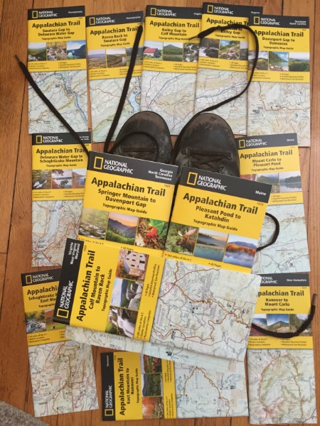
National Geographic Appalachian Trail guide maps cover my hiking boots and inspire me to hike the trail soon
The perfect guide book for an Appalachian Trail thru hike
There are many books, guides, and maps on the Appalachian Trail. Proper research utilizing the available tools helps. All guides assist in the planning stage, but when the journey begins, what should a hiker take on the actual AT adventure?
Related: Best day hiking ever in the Great Smoky Mountains
In one glance at the National Geographic Appalachian Trail Map Guides, and I am sold that these guides rock. I have only section hiked the Appalachian Trail; however, I have solo backpacked in many rugged wilderness areas. Most notably, I have hiked Big Bend National Park, Great Smoky Mountains, and Zion. As a result, I believe these guide books would make the perfect tool for an Appalachian Trail hike.
It would not be necessary to have all 13 maps in the backpack at one time. A hiker could mail the booklets not in use to future spots along the trail. Sections already hiked could be mailed home or given to hikers coming from the opposite direction.
The National Geographic Appalachian Trail guide maps are more than just maps
The name map guides is a fitting title to this series because they are more than just maps. A thru hike contains unique obstacles unlike other hiking adventure. A simple map with basic trail information works for a day or overnight hike, but not for something as complex as a 2,000 mile trail.
Long distance hikers need more information. They require resupply information, post office information, and they need to know where to find the next restaurant and shower. The National Geographic Appalachian Trail maps guides contain this extra information. In addition, the size of the booklets allow for easy storage in a backpack pocket or perhaps a fanny pack.
Both thru and section hikers would enjoy these guide books. The nice aspect about having 13 different booklets is section hikers only have to purchase one or two editions. Thru hikers would only need to carry one or two at a time.
What is included in each National Geographic Appalachian Trail map guide
First of all, the main feature of each booklet is the map. They are detailed, waterproof, topographic, and they include points of interest along the trail. The first map guide includes Amicalola Falls State Park in Georgia and the approach trail. The map detail includes mileage from point-to-point, camping locations, side trails, points of interest both on the trail and right off the trail, and important amenities along the way.
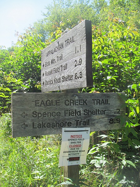
Abundant signage is found along the trail; however, maps and guides like the National Geographic Appalachian Trail map guides still rule
Each booklet includes a two page chart with detailed camping information. This chart indicates the type of camping available, whether there is water access, a toilet, if there is a fee, and indicates the location of the camp spot pertinent to the trail.
For thru hikers, refueling information is critical; therefore, each booklet contains information on the various towns found along the trail. There is a short synopsis of each town, and its important hiker amenities including the all important post office. This is especially relevant as it helps thru hikers plan how much food they need to obtain at each stop.
After an examination of the National Geographic Appalachian Trail guides, I am convinced they would be a great resource and in conclusion, perfect for thru and section hikers alike. However, the true judge of the map guides is how it fares during an outdoor adventure. I intend to test them out on the trail real soon, and I will report back when I do.
 About Appalachian Trail Topographic Map Guides
National Geographic’s 13 all-new Appalachian Trail Topographic Map Guides cover the iconic trail mile-by-mile from Georgia to Maine, in a unique booklet format that is backcountry durable, lightweight, waterproof, and tear-resistant. Printed in the USA, these innovative maps are rapidly becoming essential tools for everyone from day trekkers to thru hikers. Each guide includes detailed topographic maps at a scale of 1 inch = 1 mile, with each page centered on the trail, overlapping with adjacent pages so there is little chance of getting lost. Helpful trail profiles show the distance between shelters, camping areas, and trail access points. The front pages of the guides feature resupply locations, key points of interest, safety guidelines, local contact information, and more. Proceeds from the purchase of a National Geographic map help support the Society’s vital exploration, conservation, scientific research, and education programs.
Purchase Links
Adventure on!
The goal of Traveling Ted is to inspire people to go on an outdoor travel adventure and provide tips on where and how to go. If you liked this post then sign up for the email newsletter. Notifications are sent out once or twice a month with what is new with Traveling Ted’s adventures. There is no spam and email information will not be shared. Other e-follow options include Facebook (click on the like box to the right) or twitter (click on the pretty bird on the rainbow above).


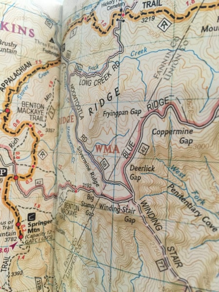



In this digital age, it’s amazing to me how many things are still so important in print! I’m glad these are such a good resource for hikers!
Thank you for sharing your thoughts!
I look forward to trying them out on the iconic trail really soon. Thanks Trish.
On my bucket list. Last time I tried inducing my family to hit the AT it created a mutiny. We settled on a bike ride across the country…so not too bad.
But the Trail awaits, beckons. Maybe getting the maps and hanging them around the house…
Hello Rob,
This is a great destination for the bucket list. Hope you get to hike a section soon.